Crisis Response
How your smartphone could help save your life in an emergency
Google partners with emergency services to improve location information technology for first responders
5-minute read
Christian Steiner is a rescue helicopter pilot working in the Lower Austrian Alps. It’s a region that can be as perilous as it is breathtaking. Since the area is popular with hikers, paragliders, and skiers, accidents are common. The problem is, until recently, when Christian headed out on a rescue mission in the vast Alpine wilderness, he didn’t always know where to look.
For years, he had to depend on outdated location technology, which could only estimate a caller’s location based on the nearest cell tower. That estimate could range from 100 meters to 20 kilometers, which could mean flying to the wrong peak or even the wrong mountain.
This wasn’t an issue just for helicopter pilots like Christian; the problem has plagued the field of emergency rescue for years, particularly since the invention of the mobile phone. Emergency calls from landlines are connected to an exact street address, but mobile phone calls can be coming from anywhere.
Callers are often disoriented, distressed, and unable to describe exactly where they are. And the extra minutes spent trying to find them can have disastrous – even fatal – consequences.
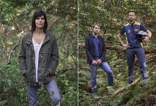
From left: Maria Garcia Puyol, Benoît Vivier, Christian Steiner.

“You can call a car to your front door, but in an emergency when every second matters, an ambulance has to rely on outdated technology to figure out where you are.”
Maria Garcia Puyol, Google engineer
“I had always assumed that emergency responders had access to this amazing cutting-edge location technology,” says Google engineer Maria Garcia Puyol. Maria works on location services in AndroidAndroid is a mobile operating system created by Google. The platform is open source, and powers over 2.5 billion devices (manufactured by over 1,300 different brands) across the globe. phones, ensuring that the blue dot in Google Maps is as accurate as possible. When she realized emergency services didn’t receive the same type of location information that’s readily available to taxi or food delivery companies, she became determined to fix it.
Other Google engineers rallied behind Maria’s project, and she soon connected with another ally in the cause: the European Emergency Number Association (EENA). EENA had been working for more than a decade to advocate for better emergency location technology. As experts in rescue protocols throughout Europe, EENA had connections with nearly everyone in the field.
“You feel that you’re contributing to saving people. This is the reason why I wake up early every day and go to the office,” says Benoît Vivier, who manages public affairs at EENA. Though certain countries have made improvements to their location accuracy for emergency response over the years, the changes have been slow-moving and small in scale. As soon as EENA and Google realized they were working on two sides of the same problem, they decided to tackle it together.
A few months later, Android Emergency Location Service (ELS) was rolled out on over 99% of Android phones. Using a combination of information like cell tower triangulation, Assisted GPS, and Wi-Fi, the technology provides a location that can be up to 3,000 times more accurate than the previous system in most countries around the world1. Whenever an emergency call is placed from an Android phone in a country where ELS has been implemented, the coordinates are now sent automatically to emergency services. ELS location information is provided directly from the phone to emergency responders.
Search Radius with ELS
12m
6m
Search Radius without ELS
900m
14km
Before ELS, many first responders could locate emergency calls based only on the location of the nearest cell phone towers – a range potentially as wide as 20 kilometers.
Example 1
Example 2
Maria still remembers hearing her first ELS success story. In January 2017, a 7-year-old Lithuanian boy named Nojuh saw his father have a seizure and collapse in the living room. Panicked, Nojuh grabbed his father’s mobile phone and called emergency services. He didn’t know his home address, and the nearest cell tower would narrow down his location only to a 14-kilometer radius. Luckily, ELS had been implemented in Lithuania three months earlier, and the emergency services operator received Nojuh’s location—within a radius of 6 meters2. An ambulance was quickly dispatched, and Nojuh’s father was brought to a nearby hospital for medical treatment.
ELS is now active in more than 20 countries on 5 continents and helps provide location information for 2 million emergency calls per day3. As stories come in from across the globe, EENA and Google continue working to expand and hone the technology. “Our hope,” says Maria, “is that nobody else has to die because they can’t be found in time.”
As for Christian, his work will never be without risk, but he finds comfort in the fact that new technology can save him, and those he rescues, precious time. “The greatest motivation in my work is to help people, no matter what situation they find themselves in,” he says. “If I can help them, I will.”
- 1 European Union Help112 Final Report, 2017
- 2 ELS performance may vary depending on environment, network conditions, partner choice of transmission protocol and confidence level, etc.
- 3 according to Google internal data.
Watch a short documentary about the team using new location technology to help find a paraglider lost in the Austrian Alps.