Seeing through the smoke
How a committed and passionate team brought Google's wildfire boundary maps to life
4-minute read

“During a crisis, people come to Google to help them make decisions about how to stay safe. We can help on a global scale by making information available to people when it matters most.”
Yossi Matias, VP Engineering & Crisis Response Lead
Hear from Mor, Pete, and other Googlers on how the team came together to launch wildfire boundary maps
Produced in partnership with ATTN:, a media company creating purpose-driven stories
In 2010, a wildfire near their office prompted a team of Googlers to create a local emergency alert in Search. Over a decade later, this act to help people in a moment of critical need continues to propel Google’s Crisis Response team to find even more ways to surface trustworthy safety information and keep people out of harm’s way.

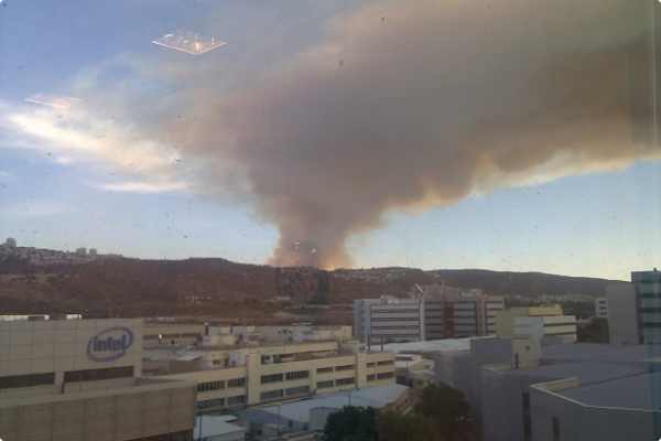
Yossi Matias and an image he captured of the Mount Carmel fire from his office in Haifa, Israel
“We saw this huge smoke mushroom on top of the Carmel Mountains, near our Haifa office ... we only saw it as a big fire and couldn’t find any helpful information [online].”
Yossi Matias, VP Engineering & Crisis Response Lead
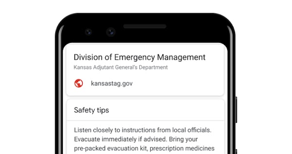
When a wildfire broke out on Mount Carmel, Israel in 2010, it spread rapidly, and the smoke billowing into the sky was visible from Google’s office in Haifa. Yossi Matias and others from his team immediately took action and within hours launched the first emergency OneBox on Google Search. It included emergency information and a hand-drawn map of the fire’s location, which was manually updated in collaboration with a local TV station throughout the fire’s 77-hour duration.
The experience of not having access to critical information stuck with Yossi. The emergency OneBox – which would ultimately evolve into SOS alerts – was helpful, but what if Google could develop more timely and comprehensive tools, like wildfire boundaries in Google Maps? Could that give people more time to act? Yossi knew the answer had to be yes. The only question was how.
Putting wildfires on the map, and the woman who led the charge
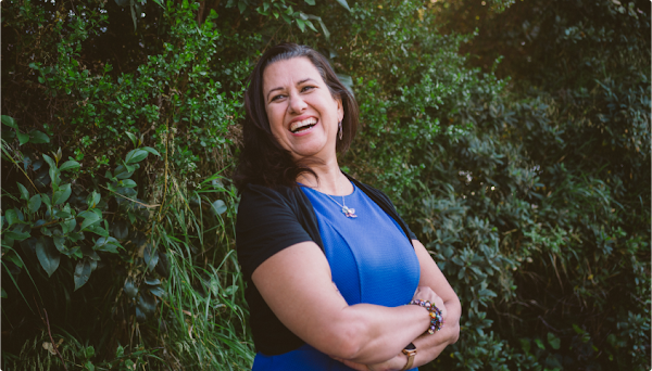
Mor Schlesinger, Engineering Director of Google’s Crisis Response team
“We have to have both feet on the ground, but our heads in the sky. I'm always thinking about the next problem we can tackle. Where can we make the most impact?”
Mor Schlesinger, Engineering Director
By 2016, Crisis Response was not only a personal priority for Yossi, it was a company priority as well. After setting the vision for SOS alerts, he started building a dedicated engineering team. But he needed someone to lead it.
Engineer Mor Schlesinger was searching for a new startup adventure in work that would help save people’s lives. Yossi was looking for someone passionate about helping others, along with a strong leadership background. In Mor, he found both, and a year later they launched SOS alerts.
In 2018, given the increased frequency and duration of wildfire seasons globally, Yossi asked Mor to research what more could be done to help. The team considered solutions like drones, balloons, and even piecing together users’ photos with machine learning.
Mor’s Product Lead, Pete Giencke, suggested it might be possible to create a fire outline on Google Maps by accessing data from GOES-16. The new satellite from NASA and the National Oceanic and Atmospheric Administration could detect heat on Earth’s surface and see “through” clouds and smoke – all in near real time and with high accuracy. But there were still challenges to overcome.
A race against time and technology
“Drawing incorrect boundaries or telling people there's fire where there's actually not could have really negative consequences for people.”
Pete Giencke, Product Manager
How would they ensure that the fire borders were as accurate as the ones being mapped on the ground? How could they map multiple concurrent wildfires? And what to do about false positives, like heat detected by the satellite that was a solar array, not a wildfire? The stakes were high and the team knew it; it drove them to find viable solutions in a matter of months. After visiting a past fire site and working closely with first responders, survivors, and with emergency services and management officials, the team launched a pilot in California in 2019.
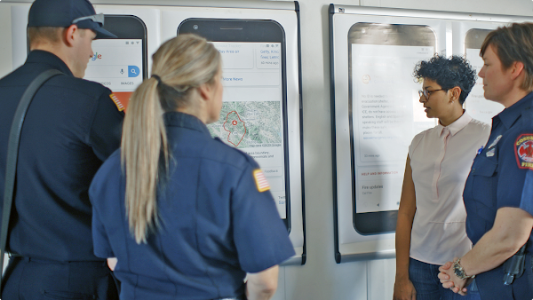
With wildfire boundary maps now available across the U.S., the Crisis Response team is working to bring the feature to more countries around the world. As their work extends beyond wildfires to also include efforts such as earthquake alerts, flood forecasting, and personal safety tools, their mission to help people find critical information quickly, when it matters most, keeps them going.